HOW SOLIDSCAN WORKS
Euclideon has designed solidscan to be as simple and easy to use as possible. Registered laser scanner point cloud data is easily imported into the program, adjusted, and then exported directly into a streaming UDS file that can then be placed onto any Web server or central LAN server. Reflections can also be added and the final result visualized in either Geoverse MDM or the solidscan Viewer application.
Step one
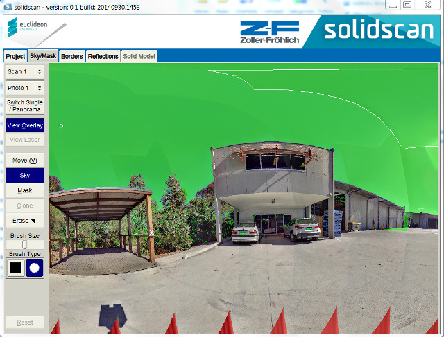 Import raw laser scanner data from the scanner into solidscan. For example, we have used a project produced with a Z+F scanner containing lots of ZFS and ZFI project files. Once the project is loaded up, the SKY/MASK tab is presented.
In this tab the SKY/MASK points can be marked. A default set of points is automatically detected by the scanner. A small amount of clean-up can be performed if some points are incorrectly marked as sky or mask points. This mode can also be used to mask out undesirable items like camera flash or the operator’s reflection in windows. Individual photos can also be edited in 2D mode.
Step two
 The BORDERS tab controls the extents of the final sealed solidscan UDS streaming point cloud file. This tab can be used to constrain the point cloud and remove erroneous points around the edges of the scan. Red squares indicate portions of the 3D volume that should not be exported by solidscan.
Step three
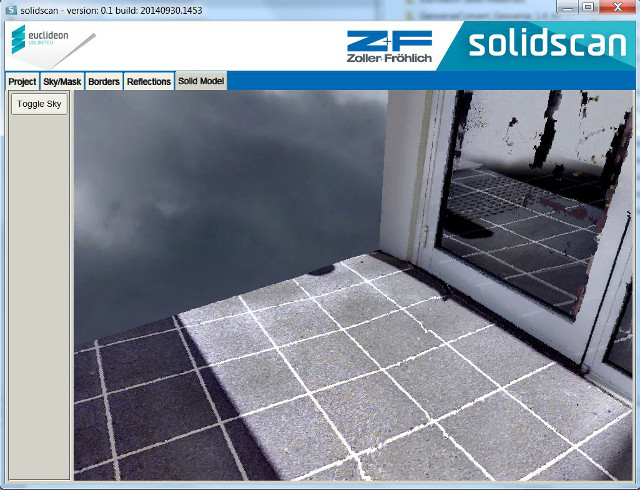
 The REFLECTIONS tab allows 3D reflection planes to be defined. These are typically objects like mirrors, doors or even walls with gloss paint. Defining these surfaces is a simple process of a few clicks. These surfaces “snap” directly to LiDAR points and effectively super-impose a polygonal plane in front of the 3D points. This polygonal plane then has high-resolution photographs mapped onto it for an outstanding visual result in areas where laser scanners normally suffer issues with noise from reflective surfaces.
Step four
 Simply click the ‘Construct High-Res Solid Model’ button to begin the final stage of processing to produce the sealed, colour-blended solidscan point cloud. When processing is completed, this point cloud can be placed on a central server and streamed instantly to hundreds of users – provided they have Geoverse MDM installed. Geoverse MDM will instantly open URL links to the file, and best of all no server-side software is required. This process is as simple as placing a file on Dropbox, and even an ordinary computer can become a server of crystal-clear solidscan point clouds to hundreds of users.
MEIXNER IMAGING GMBH is the official distributor for Euclideon’s ready-made Geoverse software.
Visualization and Manipulation of unlimited amounts of data in realtime from anywhere in the world. Our products open the door to a wide range of revolutionary new applications across the industries.